Respond to the pandemic
Maps and analyses provide a common frame of reference and integrate all types of relevant data. Maps can aid better visualization, understanding, and response planning for decision-makers in a rapidly changing environment.

Esri Rwanda response to COVID - 19
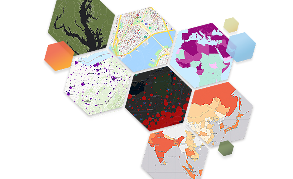
Location intelligence changes the fight against coronavirus disease 2019 (COVID-19). Maps and geographic information systems (GIS) provide valuable insights to help organizations respond to the crisis, maintain continuity of operations, and support the process of reopening.
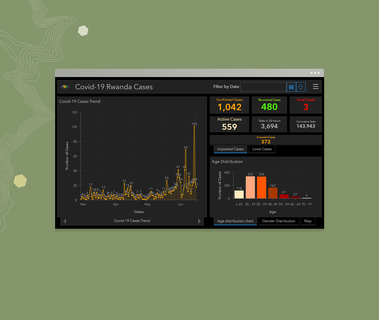
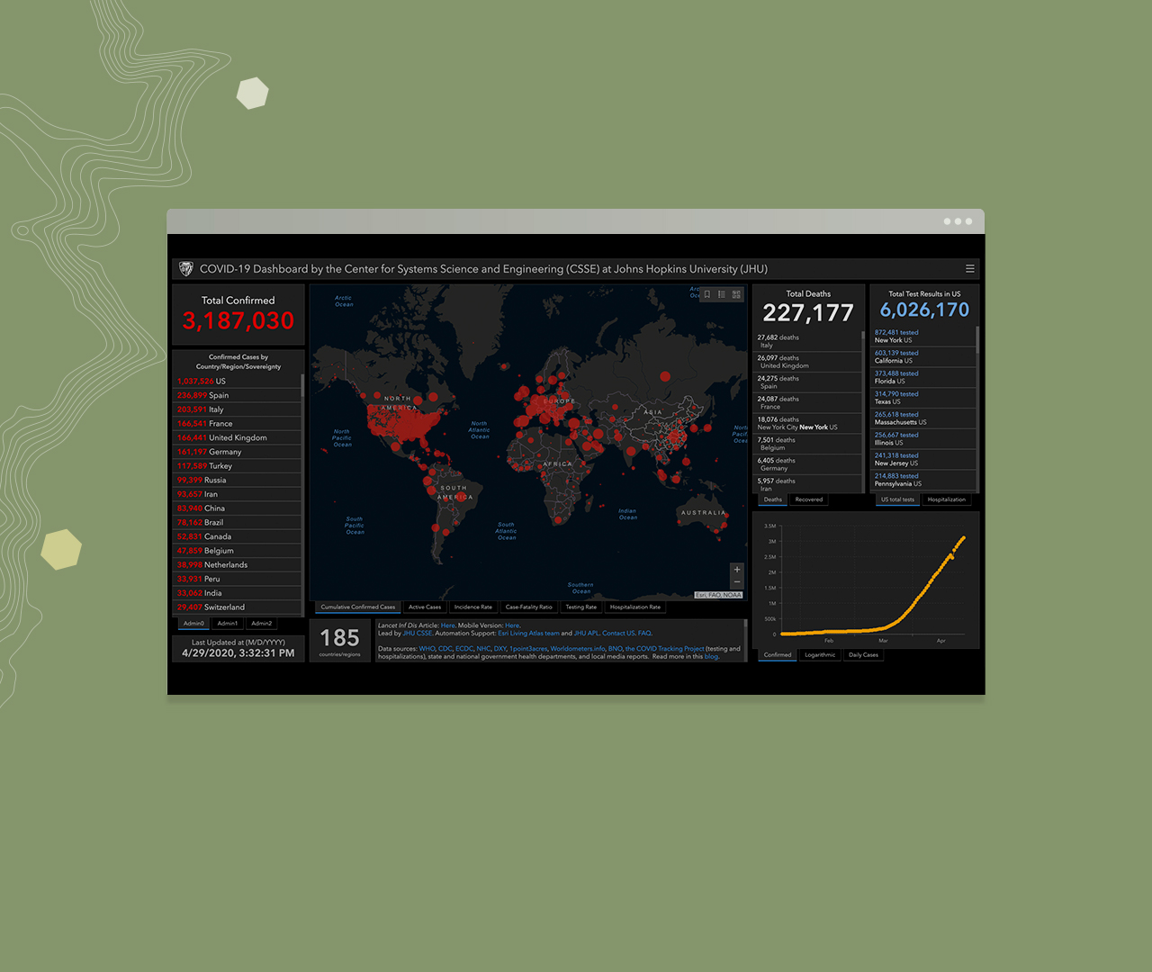
Stay informed about Covid-19 latest updates from Rwanda and globally.