Guide growth
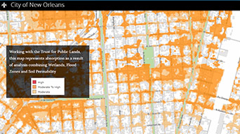
Use maps and analysis to guide open space, housing, infrastructure, and industry policies.
Green spaces, well-planned roads, recreation, and affordable housing—these features attract people to a community. Planners, economic developers, and urban designers depend on the smart maps and spatial analytics in Esri's ArcGIS software to find the best ways to deliver what people want—a high quality of life and sustainable growth.
SUCCESS STORY
In Johns Creek, Georgia, the city makes data publicly available to enhance the lives of citizens. By sharing public works updates, such as road closures, in the traffic and navigation app Waze, the city helps drivers avoid delays. Using GIS software to give businesses access to data encourages them to develop apps, find new sites, and create services.

Transform static data into 3D models to see projects from every angle, assess feasibility, and avoid costly mistakes.
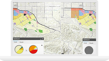
Manage the entire planning process—data, site suitability, comparisons, and reporting—in one place. Access your planning dashboard anywhere, anytime.
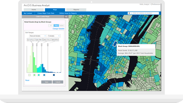
Get data-driven maps and reports that show why your community is the best place to start or grow a business.

Smart Communities
Use forward-thinking policies and procedures to enable data-driven decisions, maintain constant awareness of community activities, and stay connected with your constituents.
Green infrastructure
A framework for sustainable growth
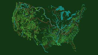
Preserve and connect open spaces, watersheds, wildlife habitats, parks, and other critical landscapes. Protect the environment. Help the economy thrive. Enhance quality of life.

ArcGIS Hub
Notify me when there is a new event
Esri partners offer specialized solutions built on ArcGIS to solve your real-world challenges.