Support policy
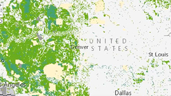
Map resources, assets, and incidents nationwide to understand how they intersect with proposed policies.
Quality of life depends on real-time decision-making. Location intelligence lets you quickly see where things are happening and how information is connected—from responding to citizens to funding a mandate. GIS connects citizens and government to support transparency and evidence-based problem solving.
SUCCESS STORY
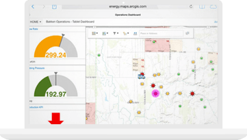
Using real-time traffic information, the county keeps 1.8 million people traveling smoothly through 62 miles of expressways and 635 miles of roadways. Decision-makers respond quickly to traffic congestion and commute delays, improving safety while reducing costs.
Answer questions you didn't know to ask, and quickly get results using a web-based data analytics workbench for exploring data.
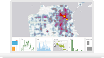
Monitor activities and stay aware of unfolding events by using real-time maps and infographics. Use data to respond faster and adjust to changing conditions.
Analyze and display real-time, streaming data from sensors, mobile devices, and social media feeds. Automatically tailor your focus to the events that matter most.

Smart Communities

GIS for federal policy making
ArcGIS Hub
Notify me when there is a new event