Network Operations & Maintenance
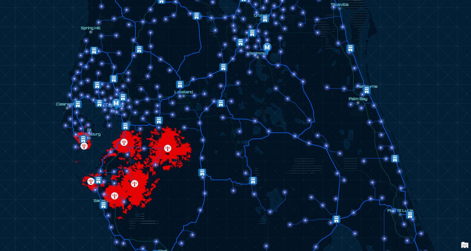
GIS optimizes resource & network optimization Unifies OSS/BSS through a common understanding of location. Enhances real-time situational awareness.
Everything in telecommunications happens somewhere. As the world leader in location technology, Esri provides the most advanced capabilities in the industry. The enterprise GIS solution platform merges with major partner networks to help you stay ahead.

Location intelligence is fundamental to all communication services— mobile and fixed, residential and enterprise. Esri’s ArcGIS is a complete GIS for telecommunications that empowers all aspects of an organization with geospatial infrastructure powered by the Esri Geospatial Cloud. ArcGIS offers a GIS system of record, system of engagement, and system of insight that leverage the power of location intelligence to directly support planning and engineering, network operations and maintenance, customer service, sales and marketing, and IT. With ArcGIS, meet your organizations’ next gen network initiatives and digitally transform your business.
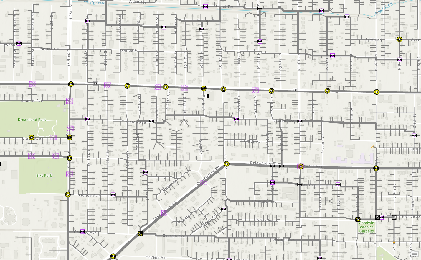
The network itself is the lifeblood of a communications service provider. Field employees and contractors are constantly at work building it, adding customers to it, expanding it, fixing it, and monitoring it. Use the power of location to optimize that work, facilitate near real-time updates between the field and office, and keep customers and field employees safe and informed.
Communications service providers collect massive amounts of data: about customers, about the network itself, network usage, wifi hotspots, and much more. Adding ArcGIS to your analytics portfolio brings the power of location to bear: visualize data on a map for greater understanding, or incorporate location or space/time variables to seek deeper insight. Location Analytics exposes patterns or trends not often detected from tables alone and then helps explore why that trend might be happening or what is likely to happen if it continues unchecked.
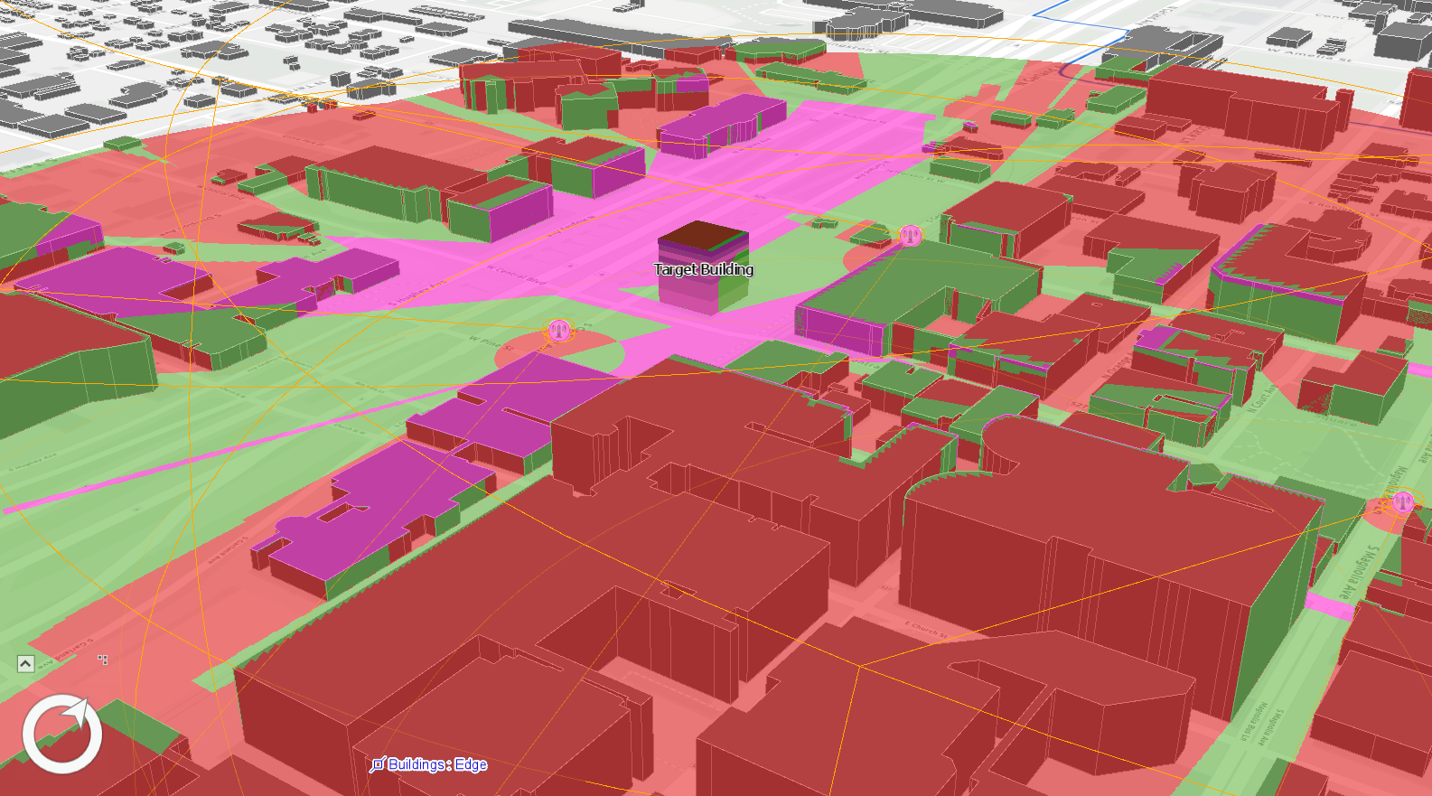
A communications service provider is only as good as their network and the best ones consistently innovate to provide attractive options to customers. Whether you’re building 5G networks, deploying small cells, densifying fiber, implementing SDN, delivering fixed wireless, or adopting DOCSIS 4.0, all networks have one thing in common: where they happen. ArcGIS uniquely leveraging that common characteristic to deliver real-time network operations.
Communications service providers are evolving the services they offer not only to meet customer demand but to gain new markets and use cases. The emergence of IoT and smart devices is transforming the connection needs of consumers, businesses, and government organizations. ArcGIS adds mapping and location capabilities to XR offerings, enhances drone and 3D data acquisition workflows, and powers Smart initiatives such as cities, utilities, and beyond.
As networks evolve to meet the explosive increase in customer demand, communications service providers must digitally transform the way they run their own businesses to stay competitive. Workflows and processes that satisfied needs 5, 10, or 20 years ago simply won’t scale. That’s why communication service providers are turning to ArcGIS to replace paper forms with connected apps and web services based workflows to facilitate near real-time exchange of information.

Enable Digital Transformation across the Organization.

Videos

Community

News
Social Media

Partnering

Esri DevSummit 2020
March 10 - 13 I Palm Springs, CA

FTTH Conference 2020
April 21 - 23, 2020 I Berlin, Germany

Esri EuroGeoConX
May 12 - 14, 2020 I Amsterdam, Netherlands

Big 5G Event
May 18 - 20, 2020 I Dallas, Texas

Esri UC 2020
July 13 - 15, 2020 | Virtual
Begin a conversation online
Speak with a representative