Strategic asset management
Manage physical assets and reduce life cycle cost for your port.
SUCCESS STORY
At this busy port, a ship sails in every six minutes. Now the port must double throughput without expanding. ArcGIS software supports this massive goal and the mission to be the safest and most responsive, efficient, and sustainable port in the world.
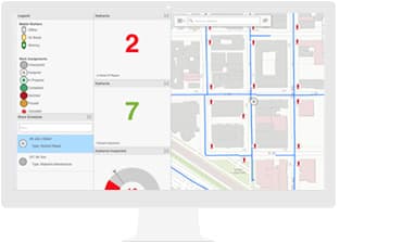
Empower your workers to have instant access to the information they need, wherever they are.
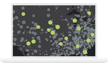
Stream massive amounts of big data into one spatial powerhouse that filters it and alerts you to events you need to know about.
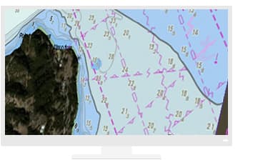
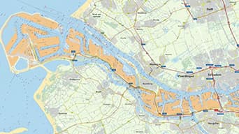
Get a comprehensive view of your data with ArcGIS. Visualize real-time port operations with your maritime data.
Esri parters offer specialized solutions built on ArcGIS to solve your real-world challenges.